Subsurface boundaries are invisible to the naked eye. A feature, not a bug: This invisibility forced us to develop ecological contrast agents that make the underground reveal itself.
Ecological Soil Contrast Agents: Making the Underground Visible Through the Soil Itself
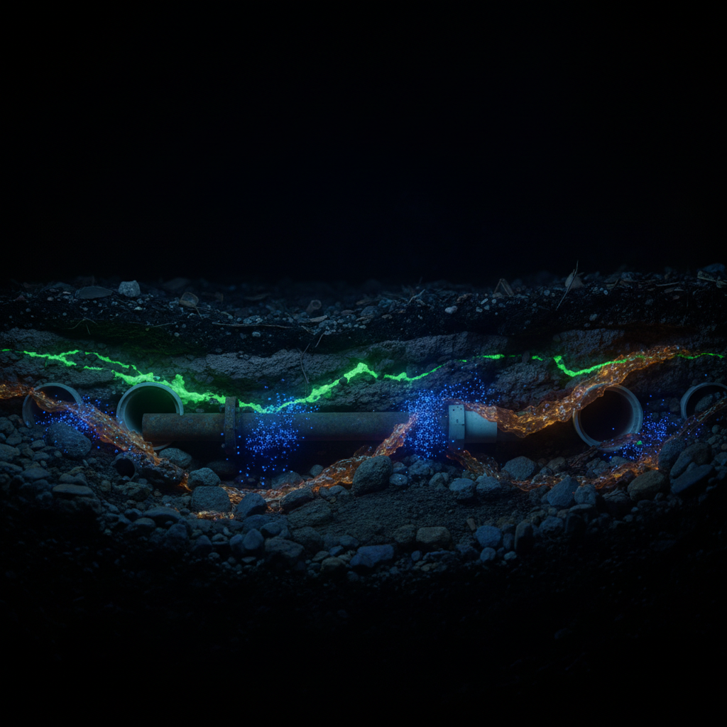
Date: 2026-03-25 Project: Making the Underground Visible (be.liviu.ai) Location: Wilmersdorfer Strasse, Charlottenburg, Berlin Geology: Warsaw-Berlin Glacial Spillway (Urstromtal) -- sandy/gravelly glacial deposits, water table 2-6m
The Core Insight
In medicine, we routinely inject substances into the body to make invisible structures visible:
- Barium for X-ray GI imaging
- Gadolinium for MRI contrast
- Iodine for CT angiography
- FDG (fluorodeoxyglucose) for PET metabolic imaging
- Microbubbles for ultrasound contrast
- Technetium-99m for SPECT nuclear imaging
The question: Can we do the same for the earth -- impregnate soil with ecological, non-toxic substances that make underground infrastructure detectable from the surface?
The answer: Yes. Many of these techniques already exist and have been used for decades in hydrogeology, environmental remediation, and utility detection. What is new is the idea of combining them systematically as a "contrast enhancement protocol" for urban underground imaging.
The Medical Analogy: Contrast Agent Crosswalk Table
| Medical Agent | Imaging Modality | What It Does in the Body | Underground Equivalent | Underground Detection Method | Maturity |
|---|---|---|---|---|---|
| Barium sulfate | X-ray/fluoroscopy | Dense, absorbs X-rays in GI tract | Dense metallic slurry or radar-reflective pipe coating | GPR (strong dielectric contrast) | CONCEPTUAL |
| Gadolinium chelate | MRI | Alters magnetic relaxation of nearby protons | Magnetite (Fe3O4) nanoparticle suspension around pipes | Magnetometer survey | RESEARCH (biomedical proven, soil application emerging) |
| Iodinated contrast | CT angiography | Absorbs X-rays in blood vessels | Saline tracer injection (NaCl solution around pipes) | Electrical Resistivity Tomography (ERT) | PROVEN -- decades of use in hydrogeology |
| FDG | PET | Metabolically active tracer accumulates in active tissue | Fluorescent dye tracers (uranine, rhodamine) | Fluorescence spectroscopy at sampling points | PROVEN -- standard hydrology since 1800s |
| Microbubbles | Ultrasound | Reflect ultrasound strongly at gas-liquid interface | Air injection (sparging) into saturated soil | GPR and seismic surveys (gas-water interface = strong reflector) | PROVEN in remediation, NOVEL for imaging |
| Technetium-99m | SPECT | Gamma-emitting radiotracer | Carbon quantum dots (CQDs) -- fluorescent, non-toxic nanotracer | Fluorescence detection at ppb levels | EMERGING -- active research |
| Indocyanine green | Near-IR fluorescence | Fluoresces under near-infrared light | Sulforhodamine B / Tinopal CBS-X | UV-fluorescence field detection | PROVEN in tracer hydrology |
1. Established Tracers: Fluorescent, Saline, and Gas (Decades of Use)
1.1 Fluorescent Dye Tracers
Uranine (sodium fluorescein) is the gold standard of hydrogeological tracers. It has been used for groundwater dye-tracing in karst terranes since the late 1800s. Key properties:
- Detection limit: 0.005 ug/L (5 parts per trillion) -- extraordinarily sensitive
- Extremely high water solubility
- Environmentally harmless at tracer concentrations
- Visible fluorescence under UV light (green-yellow)
- Biodegradable -- breaks down under sunlight and microbial action
Application to infrastructure: Inject uranine into water mains during flushing. Any leak produces a detectable plume in surrounding soil/groundwater. Surface monitoring wells or probe samples detect the fluorescence, mapping leak locations.
Multi-dye approach: Different dyes for different utilities:
- Uranine (green fluorescence) -- water mains
- Sulforhodamine B (red fluorescence) -- sewers
- Tinopal CBS-X (blue-white fluorescence) -- stormwater
- Eosin (orange fluorescence) -- district heating
This differential tracer approach is already proven in dam seepage studies where multiple dyes were injected at different points to map flow paths.
Limitations: Uranine sorption increases at higher salinities; unstable under heat and extreme pH. In Berlin's neutral-pH sandy groundwater, these limitations are minimal.
Sources:
- Dye Tracer overview - ScienceDirect
- Fluorescent tracer tests for dam leakage - ScienceDirect
- Uranine groundwater tracer detection - ScienceDirect
1.2 Saline Tracers + Electrical Resistivity Tomography (ERT)
The iodine-for-CT equivalent: Injecting salt water (NaCl solution, typically 40 g/L) into soil dramatically changes its electrical conductivity. This conductivity change is detectable from the surface using ERT -- an array of electrodes driven into the ground that measures how electrical current flows through the subsurface.
Proven capability: A saline tracer of 1000 liters at 40 g/L concentration was monitored via time-lapse surface ERT, producing 2D subsurface images that tracked tracer movement in real time. The method covers a wide area in relatively short time and produces spatial images without needing boreholes at every measurement point.
Berlin advantage: Berlin's sandy glacial soil (Urstromtal) is predominantly cohesionless sand and gravel with "great water conductive capacity" -- ideal for both tracer transport and ERT imaging. The sandy, well-drained soil allows good electrical signal penetration (unlike clay-rich soils that attenuate signals).
Application to infrastructure: Inject saline tracer at known pipe locations during planned maintenance. Run time-lapse ERT surveys. The saline plume traces the pipe network and reveals leak points where tracer concentrations accumulate. The tracer dissipates naturally through groundwater flow.
Equipment: ERT systems are available for rent and can be deployed on urban streets with minimal disruption -- electrodes are small metal stakes driven into soil/pavement gaps.
Sources:
- Saline tracer test monitored via surface ERT - ScienceDirect
- ERT for underground void detection - ScienceDirect
- ERT review for underground imaging - ScienceDirect
- Saline tracer in heterogeneous alluvium - Wiley
1.3 Gas Tracers
Hydrogen is now the most popular tracer gas for underground pipe leak detection, overtaking helium (which is scarce and expensive) and SF6 (a potent greenhouse gas). The method:
- Inject tracer gas (typically 5% H2 / 95% N2 mix -- safe, non-flammable) into the pipe system
- Gas escapes through any leaks
- Walk slowly along the pipe route with a portable gas analyzer
- Surface readings map leak locations
Sensitivity: Detection in parts-per-billion (ppb) range using modern analyzers.
Cost: Underground water pipe leak detection using hydrogen tracer gas costs less than $2,000 per survey.
Ecological: Hydrogen is the most abundant element in the universe, non-toxic, and dissipates harmlessly. Nitrogen is 78% of the atmosphere.
Sources:
- Tracer Gas Leak Detection - Forensics Detectors
- Underground Water Pipe Leak Detection with Hydrogen - Apex Vacuum
- Helium Gas Detection Technology - Underground Surveying
2. Natural Contrast Agents: Infrastructure Already Emits Detectable Signals
A key insight: underground infrastructure is ALREADY "emitting" its own contrast agents. We just need to detect them systematically.
2.1 Chemical Signatures
| Infrastructure | Natural Emission | Detection Method |
|---|---|---|
| Water mains | Chlorine residual from treated water | Soil gas sampling / chlorine detector |
| Sewers | Hydrogen sulfide (H2S), methane (CH4) | Soil gas survey grid, "rotten egg" odor |
| Gas pipes | Methane + mercaptan odorant | Mobile methane survey (LiDAR, portable analyzer) |
| District heating | Heat (up to 130C supply, 60C return) | Infrared thermography from surface or drone |
| U-Bahn/tram | Stray DC current from traction return | DC potential survey with reference electrode |
| Contaminated sites | VOCs, heavy metals | Soil vapor extraction sampling |
2.2 Soil Gas Surveys
A soil gas survey involves systematic sampling on a grid pattern. Push a probe into the ground, draw a gas sample, analyze. When done across an area, the resulting map directly reveals:
- Gas pipe routes and leak points (methane)
- Sewer routes and condition (H2S, methane from decomposition)
- Contamination plumes (VOCs)
Berlin practice: BWB (Berliner Wasserbetriebe) already conducts continuous leak detection using "Acoustic Zone Monitoring" (AZ) -- hydrophone sensors on fittings that detect leak sounds. Their damage rate is only 0.06% per year with water losses of just 2% (well below the German national average of 5.2%). This demonstrates that Berlin's utility operators already practice advanced detection.
Sources:
- Methane Soil Gas Survey - GEO FORWARD
- Gas Mapping LiDAR for aerial methane detection - Bridger Photonics
- BWB Leckortung with modern technology - Wassermeister
2.3 Thermal Signatures
District heating pipes run at high temperatures (70-130C supply). This heat conducts through pipe insulation, through the surrounding soil, to the surface. Infrared thermography detects this:
- Surface thermal patterns reveal buried pipe routes
- Hot spots indicate insulation failures or leaks
- Drone-mounted thermal cameras can survey entire street segments in minutes
- Combined with GPR, provides comprehensive utility mapping
In one application: "the penetration of hot water causes the affected earth to heat up, so it is possible to discover where the pipeline is broken underground via thermal camera, meaning it is no longer necessary to excavate kilometers of pipelines to discover a single rupture."
Sources:
2.4 Electrical Signatures (Stray Current)
Berlin's U-Bahn and tram systems use DC traction current with running rails as return conductor. Significant current leaks into the ground (stray current) and flows through nearby metallic infrastructure. This stray current is a "natural contrast agent" -- it reveals:
- Proximity and geometry of rail infrastructure
- Location of metallic pipes that carry stray current
- Corrosion risk zones where stray current exits pipes
Detection: DC potential surveys using copper-copper sulfate reference electrodes. The voltage patterns map both the rail infrastructure and the metallic pipe network simultaneously.
Sources:
2.5 Vegetation Anomaly Detection (The Living Sensor Network)
Perhaps the most elegant "natural contrast agent": plants themselves respond to underground conditions and can be read from satellite or drone imagery.
NDVI (Normalized Difference Vegetation Index) analysis of satellite/drone multispectral imagery reveals:
- Greener-than-normal vegetation over leaking water pipes (extra moisture)
- Stressed vegetation over contamination plumes
- Growth pattern changes over shallow infrastructure
This has been validated: "By analyzing satellite images and running vegetation change detection analysis, one service determined the location of a pipeline release and when it started, discovering the leak five days prior to the client's knowledge."
Optimal detection: During early-vegetation growth phases (NDVI 0.30-0.45) and post-harvest periods, when subtle moisture differences have the greatest effect on plant growth.
Sources:
- Vegetation indices for pipeline leak detection - ADS
- Multispectral remote sensing for water leak detection - PMC
- How satellite technology monitors pipelines - Stantec
3. Smart Materials: Conductive Polymers, Piezoelectric Particles, Quantum Dots
3.1 Conductive Polymer Injection (PEDOT:PSS)
Concept: Inject a water-dispersible conductive polymer solution into soil around infrastructure. The polymer increases soil electrical conductivity in a controlled zone, making the infrastructure detectable via ERT or electromagnetic surveys.
PEDOT:PSS (poly(3,4-ethylenedioxythiophene) polystyrene sulfonate) is a water-processable conductive polymer with conductivity ranging from 10^-4 to 10^3 S/cm. Recent research has produced biodegradable variants (PEDOT:AlgS) suitable for transient applications.
Environmental applications: PEDOT-based conducting polymers are already being explored for "environmental bioelectronics" -- low-cost, solution-based sensors for agriculture and environmental monitoring.
Status: [UNGROUNDED -- no direct soil injection studies found. The concept is extrapolated from biomedical and agricultural research. Feasibility in Berlin's sandy soil is plausible given water-processability, but regulatory approval under BBodSchG would be required.]
Sources:
- PEDOT:PSS - Wikipedia
- Conducting polymers in the field - PNAS
- Biodegradable conducting polymers for bioelectronics - Nature
3.2 Piezoelectric Geocables and Particles
Concept: Embed piezoelectric materials along pipe routes during maintenance/installation. These materials generate electrical signals when mechanically stressed (traffic above, thermal expansion, ground movement). Surface sensors detect the signals, mapping the pipe network.
Proven technology: Sensor-enabled piezoelectric geocables (SPGC) have been developed using PVDF (polyvinylidene fluoride) piezoelectric films. These can:
- Accurately locate crack positions in soil/infrastructure
- Achieve graded early warning of soil disasters
- Capture environmental vibration signals for monitoring
Excitation frequency range: 10 Hz to 300 Hz, with 50-150 Hz most effective for soil transmission.
Status: Active research for geotechnical monitoring. Not yet applied to urban infrastructure mapping, but the technology transfer is straightforward. [PARTIALLY GROUNDED -- technology proven for geotechnical applications, urban infrastructure application is extrapolated.]
Sources:
- Piezoelectric sensing for geological monitoring - ScienceDirect
- Piezoelectric geocable-geogrid for slope monitoring - ScienceDirect
- Piezoelectric sensors for structural health monitoring - PMC
3.3 Carbon Quantum Dots (CQDs)
The next-generation tracer: Carbon quantum dots are fluorescent nanoparticles synthesized from carbon-rich precursors (biomass, waste materials, organic compounds). They are:
- Non-toxic: Low cytotoxicity, good biocompatibility
- Highly fluorescent: Detectable at ppb concentrations
- Biodegradable: Carbon-based, decomposes naturally
- Cheap: Synthesizable from waste biomass
- Small: Nanoscale (2-10 nm), excellent transport in porous media like sand
Groundwater tracer validation: CQDs have been tested as groundwater tracers and show "tracer-like breakthrough ability" -- meaning they transport through subsurface soil similarly to dissolved chemical tracers but with lower diffusion (staying more concentrated).
Application: CQDs injected into Berlin's sandy soil would transport readily through the high-permeability Urstromtal deposits, remain detectable at very low concentrations, and biodegrade within months.
Advantage over uranine: CQDs don't sorb onto surfaces as readily, are stable across wider pH/salinity ranges, and can be synthesized with different emission colors for multi-utility identification.
Sources:
- Carbon quantum dots as nano-tracer for groundwater - ScienceDirect
- Carbon quantum dots for water seepage tracing - Nature
- CQDs for improving soil health - PMC
- Quantum dots in environmental fate studies - ScienceDirect
3.4 Self-Healing Concrete with Indicator Capsules
Concept: Embed microcapsules in pipe bedding/concrete encasements that rupture when cracks form, releasing a detectable marker (fluorescent dye, conductive fluid, or odorant). Pipe damage triggers automatic "contrast enhancement."
Proven mechanism: In self-healing concrete, microcapsules rupture on crack formation. Acoustic emission monitoring detects capsule rupture events with spatial and temporal precision. Ultrasound pulse velocity (UPV) verifies crack closure after healing, with regain up to 100% on healed zones.
Enhancement for detection: Instead of self-healing agents, capsules could release:
- Fluorescent dye (detectable by soil sampling)
- Conductive fluid (detectable by ERT)
- Odorant (detectable by gas survey)
- pH indicator (detectable by soil probe)
Status: Self-healing concrete is proven; the adaptation to "self-indicating" infrastructure with detectable markers is [CONCEPTUAL but technically straightforward].
Sources:
- Microcapsule self-repairing concrete review - MDPI
- Smart capsules network for concrete monitoring - ScienceDirect
3.5 Thermochromic Coatings
Concept: Apply temperature-indicating paint to pipes during installation or maintenance. When excavated later, the pipe's thermal history is immediately visible:
- Color changes indicate overheating (insulation failure)
- Permanent chemical indicators show if rated temperature was ever exceeded
- Reversible leuco dyes show current temperature state
Types:
- Leuco dyes: Reversible color change within ~3C differential
- Thermochromic liquid crystals: Pass through spectrum (tan-green-blue) as temperature varies
- Chemical indicators: Permanent one-time color change at rated temperature
Application: Coat district heating pipes with thermochromic paint. During any excavation near the pipe, workers immediately see pipe condition without instruments.
Status: [PROVEN technology for pipe coatings; novel application as underground infrastructure indicator.]
Sources:
- Thermochromic Paint Series - IRISS
- Temperature Indicating Paints - thenex GmbH
- Temperature Indicating Coatings - GlobalSpec
4. Acoustic Enhancement: Water Saturation, Air Sparging, Resonant Markers
4.1 Water Saturation for Improved Coupling
Berlin's water table is already high (2-6m in the Urstromtal), which is both a challenge and an advantage. Saturated sandy soil provides:
- Good seismic wave transmission (higher velocity in saturated vs. dry sand)
- Clear water table reflector for GPR (strong dielectric contrast at saturation boundary)
- Natural acoustic coupling without additional agents
Berlin's sandy soil is especially well-suited: "excessively drained and well drained, sandy soils are considered well-suited to high resolution, deep profiling with GPR."
4.2 Air Injection (Sparging) as Acoustic Contrast
Concept: Inject air into water-saturated soil around infrastructure. The air bubbles create a zone of dramatically different acoustic and dielectric properties -- a powerful reflector for both GPR and seismic surveys.
Medical analogy: This is the exact underground equivalent of microbubble contrast agents in ultrasound imaging. Gas-liquid interfaces produce the strongest reflections in both medical and geophysical imaging.
Proven in remediation: Air sparging is a standard environmental remediation technique (injecting air to volatilize contaminants). Its effect on geophysical surveys is well-known: air in saturated soil creates "bright spots" and "attenuation zones" in GPR data.
Application: Temporarily inject air at pipe depth via small-diameter boreholes. Run GPR survey immediately. The air zone outlines the pipe location with dramatically enhanced contrast.
Ecological: Injecting air into soil is about as ecological as it gets -- it's the same air that's already above the surface.
Sources:
4.3 Vibration Excitation of Pipe Networks ("Acoustic Pill")
Concept: Place a controlled vibration source (inertial shaker) on an accessible pipe fitting (manhole, valve, hydrant). The vibration propagates through the pipe network. Surface geophones measure the ground vibrations above, mapping the pipe route.
Proven technology: Shear waves generated at the ground surface with subsequent ground surface vibration measurement using geophones has been demonstrated for detecting buried non-metallic pipes. Key findings:
- Phase information of ground vibration maps pipe routes (more robust than magnitude)
- Excitation at 50-150 Hz is most effective in typical soils
- Detection works for both metallic and plastic pipes
Enhancement: Instead of surface excitation, excite FROM INSIDE the pipe network. An acoustic source mounted at a pipe access point "illuminates" the entire connected network from within -- like swallowing a contrast agent that broadcasts its location.
Sources:
- Shear wave technique for buried pipe detection - ScienceDirect
- Vibroacoustic method for non-metallic pipelines - MDPI
- Acoustic methods for locating underground pipes - Semantic Scholar
4.4 Resonant Markers (Fiducial Markers for the Underground)
Concept: Bury small passive resonant devices at known points along pipe routes. Future surveys trigger the markers, which respond at their characteristic frequency, providing automatic calibration and identification.
Already deployed: The 3M Electronic Marker System (EMS) is exactly this:
- Passive antennas in waterproof polyethylene shells
- Buried alongside utilities during installation
- Frequency-coded by utility type (e.g., 101.4 kHz for telecom, 83.0 kHz for gas)
- Color-coded for visual identification during excavation
- RFID capability stores unique ID numbers
- No batteries, no maintenance, lasts as long as the pipe
- Immune to electrical interference from nearby utilities
3M XR/iD Ball Markers: 4-inch spheres with passive antennas, detectable from the surface with a handheld locator. Provide depth estimation and unique identification.
Medical analogy: These are exactly like fiducial markers used in radiation therapy -- small reference points that enable precise targeting.
Sources:
- 3M Underground Utility Markers
- 3M Magnetic Resonators whitepaper
- 3M RFID Marker Expansion - 3M News
- Passive Harmonic RFID for buried assets - PMC
5. Living Systems: Bioluminescent Bacteria, Mycorrhizal Networks, Root Patterns, Moss
5.1 Bioluminescent Bacterial Biosensors
Concept: Genetically engineered bacteria that produce light when they detect specific chemicals. Deploy in soil near infrastructure -- bacteria glow when exposed to gas leaks (methane), sewer leaks (H2S, ammonia), or contamination.
Proven field deployment: Pseudomonas fluorescens HK44 was the first genetically engineered microorganism approved for field testing in the United States. It bioluminesces as it degrades polyaromatic hydrocarbons like naphthalene. The technology has been miniaturized into "bioluminescent bioreporter integrated circuits" (BBICs) that integrate bacterial sensors with electronic detection.
Autonomous field modules: An autonomous bioluminescent bacterial biosensor module has been developed specifically for outdoor sensor networks, demonstrated for detection of buried explosives -- proving the concept works in actual soil conditions.
Application: Deploy biosensor modules along known pipe routes. Each module contains bacteria engineered for a specific target chemical. The modules transmit detection data wirelessly. A network of such modules creates a living, self-powered, continuous monitoring system.
Regulatory concern: Release of genetically modified organisms (GMOs) in Germany is regulated under the Gentechnikgesetz (GenTG). Field deployment would require approval from the Bundesamt fur Verbraucherschutz und Lebensmittelsicherheit (BVL). This is a significant regulatory hurdle. [GROUNDED for technology; REGULATORY BARRIER for deployment in Germany.]
Sources:
- Autonomous bioluminescent biosensor for buried detection - ScienceDirect
- Bioluminescent bacteria for environmental monitoring - PubMed
- Genetically engineered microbial biosensors in situ - PubMed
- Controlled field release of bioluminescent GEM - ACS
5.2 Mycorrhizal Networks as Infrastructure Proxies
Concept: Fungal mycorrhizal networks extend through the top 10 cm of soil in densities exceeding 450 quadrillion kilometers globally. These networks physically interact with underground infrastructure -- wrapping around pipes, growing along moisture gradients, avoiding toxic zones.
The Wood Wide Web as a sensor: Mycorrhizal networks transport water, nitrogen, carbon, and minerals through tubes about one-tenth the diameter of a human hair. Their architecture is shaped by the underground environment -- including the presence of pipes, cables, foundations, and contaminated zones.
Detection potential: Mapping mycorrhizal network density and architecture (via soil DNA sampling, eDNA) could reveal underground structures:
- Dense networks = undisturbed soil
- Network gaps = impervious barriers (pipes, foundations)
- Directional growth patterns = moisture gradients (indicating leaks)
Status: [HIGHLY SPECULATIVE. Mycorrhizal network mapping via eDNA is an active research area (see SPUN -- Society for the Protection of Underground Networks), but using networks as infrastructure proxies has not been studied. The concept is biologically plausible but unproven.]
Sources:
- Mycorrhizal network - Wikipedia
- Mapping underground fungal networks - Mongabay interview with SPUN
- Research on underground fungal traffic - Princeton
5.3 Tree Root Patterns as Infrastructure Maps
Concept: Tree roots actively respond to underground infrastructure -- growing toward water-leaking pipes, avoiding toxic zones, being deflected by impervious barriers. GPR can map both roots AND pipes simultaneously, and root distribution patterns indirectly reveal infrastructure even when the pipes themselves are below GPR resolution.
GPR root detection: "Detecting a tree root is very similar to detecting a water-filled plastic pipe; in both cases, the material that provides the contrast that GPR needs to reflect signal is water." In sandy soils (like Berlin's), root detection quality is highest.
Urban interactions: Arborists already use GPR to map roots interfering with city infrastructure (pipes, cables, foundations). This means the data showing root-infrastructure interaction ALREADY EXISTS in municipal arboriculture records.
Berlin application: Wilmersdorfer Strasse has street trees (Tilia, Platanus, Acer). Their root GPR scans, if available from the Bezirksamt Charlottenburg-Wilmersdorf tree management, would show root-pipe interactions and indirectly map infrastructure.
Sources:
- GPR for tree root localization under urban pavements - ScienceDirect
- GPR accurately locates roots in two soil media under pavement - AUF
- Root detection in heterogeneous anthropogenic soil using GPR - ASCE
5.4 Vegetation as Living Sensor Network
Surface vegetation responds to subsurface conditions:
- Excess moisture (from pipe leaks): Greener, denser growth in patches
- Contamination (from gas/chemical leaks): Stressed, yellowed, stunted growth
- Heat (from district heating): Earlier spring growth, later autumn senescence
- Soil compaction (from buried structures): Restricted root growth, poorer vegetation
Plant indicators: Specific species indicate specific conditions:
- Typha, Phragmites, Juncus = waterlogged soil (possible major water leak)
- Calotropis, Agave, Opuntia = dry soil (possible drainage pipe drawing moisture away)
- Mosses/lichens: Moisture-sensitive, growth patterns correlate with subsurface moisture. Remote sensing of moss moisture content uses shortwave infrared (SWIR) and middle-infrared (MIR) bands.
Practical application: Regular drone surveys with multispectral cameras (NDVI, SWIR) over Wilmersdorfer Strasse, analyzed with change detection algorithms, would detect vegetation anomalies that indicate underground infrastructure changes.
Sources:
- Environmental indicator plants - PMC
- Remote sensing of lichen moisture - Wiley
- Indicator species for ecosystem restoration - Wiley
6. 3M EMS and Existing Marker Systems (Already Deployed?)
6.1 3M Electronic Marker System (EMS)
The 3M system is the current industry standard for underground utility marking:
Product lineup:
- EMS Ball Markers: 4-inch spheres, passive antennas, frequency/color-coded by utility type
- EMS Caution Tape 7900 Series: Marker-embedded tape laid over pipe during backfill, with point markers every 8 feet
- XR/iD Ball Markers: RFID-enabled, store unique identification numbers
- Full-range markers: Surface to deep burial (up to 5+ feet)
Frequency coding by utility type (international standard):
| Frequency | Utility Type | Color |
|---|---|---|
| 101.4 kHz | Telecom/CATV | Orange |
| 83.0 kHz | Gas | Yellow |
| 121.6 kHz | Water | Blue |
| 145.7 kHz | Sewer | Green |
| 169.8 kHz | Electric/Power | Red |
Detection: 3M Dynatel Locators 7000X Series detect markers from the surface, providing position and depth estimate. Locators interface with GPS/GIS for digital mapping.
European restrictions: Some frequencies are restricted in European countries. The receiver must be configured for country-specific legal frequencies.
Berlin deployment status: [UNGROUNDED -- no specific data found on whether Berlin utilities (BWB, GASAG, Vattenfall, BVG) use 3M EMS markers. This should be verified through direct inquiry with the Leitungsauskunft Berlin.]
Sources:
- 3M Underground Utility Markers
- 3M Locating and Marking System brochure
- 3M EMS Ball Markers data sheet
6.2 Tracer Wire/Tape
Simpler than RFID markers: conductive wire or metallic tape laid alongside non-metallic pipes during installation, allowing conventional electromagnetic locating. This is standard practice for HDPE gas and PE water pipes worldwide, and almost certainly used in Berlin for modern installations.
6.3 Color-Coded Utility Identification (APWA/DIN Standard)
International color coding for surface marking and caution tape:
- Red: Electric power
- Yellow: Gas, oil, steam
- Blue: Water (potable)
- Green: Sewer, drainage
- Orange: Telecom, cable TV
- Purple: Reclaimed/irrigation water
- White: Proposed excavation
- Pink: Temporary survey marks
7. Regulatory Framework: BBodSchG, Wasserschutzgebiet, What's Legal in Berlin
7.1 German Federal Soil Protection Act (BBodSchG)
The BBodSchG (Bundes-Bodenschutzgesetz, 17 March 1998) and its ordinance BBodSchV (12 July 1999) govern the introduction of substances into soil. Key principles:
- Purpose: Sustainably secure or restore soil functions
- Precaution: Negative effects on soil must be avoided
- Remediation: Existing contamination must be addressed
- Precautionary values: Establishment of limits for substance introduction
Implication for tracer injection: Any substance deliberately introduced into Berlin's soil must not constitute a "schadliche Bodenveranderung" (harmful soil change). Tracers that are:
- Temporary (dissipate within days-weeks)
- Non-toxic (no harmful residues)
- Below precautionary values
- Used in quantities typical for hydrogeological testing
...would likely be permissible under existing practice, but formal notification to the Senatsverwaltung fur Mobilitat, Verkehr, Klimaschutz und Umwelt would be advisable.
Sources:
7.2 Berlin Water Protection Zones (Wasserschutzgebiete)
Berlin has 9 water protection zones covering ~212 km2 (nearly one-quarter of the city). The zones have escalating restrictions:
- Zone I: Immediate vicinity of wells -- strictest protection
- Zone II: Inner protection zone
- Zone III: Outer protection zone -- no wastewater discharge into ground, no oil changes
Charlottenburg status: Wilmersdorfer Strasse is in Charlottenburg-Wilmersdorf. The nearest water protection zone is Wasserschutzgebiet Tiefwerder (along the Havel, western Charlottenburg). Wilmersdorfer Strasse itself, being in the commercial center, is [LIKELY NOT within a Wasserschutzgebiet, but this must be verified via the Berlin Geoportal map layer "02.11 Wasserschutzgebiete"]. If it IS within Zone III, saline and fluorescent tracers would still be permissible at hydrogeological test quantities, but larger-scale injection would require water authority approval.
Sources:
- Water Conservation Districts - Berlin Environmental Atlas
- Wasserschutzgebiete Berlin overview
- Liste der Wasserschutzgebiete in Berlin - Wikipedia
7.3 EU Soil Monitoring and Resilience Directive
The new EU Soil Monitoring Directive (proposed July 2023, trilogue agreement April 2025) establishes:
- Common EU methodology for soil monitoring
- Monitoring of PFAS and pesticides as initial step
- Potential EU list of priority substances and watch list
- Member state monitoring systems for physical, chemical, biological soil condition
Implication: Any tracer substances used must not be on the emerging EU watch list. Traditional hydrogeological tracers (uranine, NaCl, inert gases) have decades of established safe use and are unlikely to be restricted. Novel nanomaterials (CQDs, magnetic nanoparticles) may face future scrutiny.
Sources:
7.4 What Berlin Utilities Already Do
BWB (Berliner Wasserbetriebe): Uses "Acoustic Zone Monitoring" (AZ) with hydrophone sensors and AZ-Logger devices on fittings. Data transmitted to iPad/computer. Achieves 0.06% annual damage rate, 2% water loss.
GASAG (gas utility): Standard practice for gas leak detection includes soil gas surveys and odorant (mercaptan) detection. Hydrogen/helium tracer gas testing is available for difficult-to-locate leaks.
Standard German practice: Tracer tests in hydrogeology are routine in Germany and do not typically require special environmental permits when using established tracers (uranine, NaCl, bromide) at standard concentrations. They fall under standard geological/hydrological investigation practice.
8. The Multi-Tracer Protocol: Different Tracer Per Utility Type
8.1 Protocol Design
The core innovation: assign a UNIQUE contrast agent to each utility type, enabling simultaneous detection and differentiation.
| Utility | Injected Tracer | Natural Emission | Surface Detection | Color Code |
|---|---|---|---|---|
| Water mains | Uranine (fluorescein) | Chlorine residual | Fluorescence (green) + Cl detector | Blue |
| Sewers | Sulforhodamine B | H2S, methane | Fluorescence (red) + gas analyzer | Green |
| Gas pipes | H2/N2 tracer gas | Mercaptan odorant | Gas analyzer (H2 + odorant) | Yellow |
| District heating | None needed | Heat signature | Infrared thermography | Red |
| Telecom conduit | 3M EMS markers (101.4 kHz) | None | Dynatel locator | Orange |
| Electric cables | EM signal (energized) | Stray EM field | EM locator | Red |
| U-Bahn/tram | None needed | Stray DC current | DC potential survey | N/A |
| Stormwater | Tinopal CBS-X | None specific | Fluorescence (blue-white) | Green |
8.2 Detection Protocol
A comprehensive "contrast-enhanced underground survey" would proceed in layers:
Layer 1 -- Passive detection (no injection needed):
- Infrared thermography (drone) -- maps district heating
- EM survey -- maps metallic pipes and cables
- DC potential survey -- maps stray current from rail
- NDVI vegetation analysis (drone multispectral) -- maps moisture anomalies
- Soil gas survey (grid sampling) -- maps gas and sewer signatures
Layer 2 -- Active non-invasive:
- GPR survey -- maps all detectable structures
- Seismic/vibro-acoustic survey -- maps pipe routes via vibration
- 3M EMS marker scan -- locates marked utilities
Layer 3 -- Contrast enhancement (tracer injection):
- Fluorescent dye injection during utility flushing
- Saline tracer injection + time-lapse ERT
- H2 tracer gas injection for gas pipe verification
- Air sparging at selected points for GPR contrast enhancement
8.3 Data Fusion
All detection layers feed into a single 3D model (the be.liviu.ai Three.js visualization), creating a comprehensive underground map with confidence levels for each utility identification.
9. Pilot Proposal: Wilmersdorfer Strasse 150m Contrast Enhancement
9.1 Site Characteristics
- Location: Wilmersdorfer Strasse, Charlottenburg, Berlin (approx. Kantstrasse to Bismarckstrasse, ~150m)
- Geology: Warsaw-Berlin Glacial Spillway (Urstromtal) -- predominantly sandy deposits
- Water table: 2-6m below surface
- Expected utilities: Water (BWB), sewer (BWB), gas (GASAG), district heating (Vattenfall Warme), telecom (Telekom, Vodafone), power (Stromnetz Berlin), U-Bahn U7 (BVG)
9.2 Proposed Pilot Phases
Phase A -- Baseline Passive Survey (1 day)
- Drone IR survey (morning, 04:00-06:00 for maximum thermal contrast)
- Drone multispectral survey (NDVI, SWIR)
- Soil gas grid sampling (every 5m along both sides of street)
- EM utility locator survey
- 3M EMS marker scan
- Data fusion into be.liviu.ai 3D model
Phase B -- Active Non-Invasive Survey (1 day)
- GPR survey (400 MHz antenna for optimal depth/resolution in sand)
- Vibro-acoustic survey: excite water network from hydrant, measure surface response
- DC potential survey for stray current mapping
- Data fusion update
Phase C -- Contrast-Enhanced Survey (2-3 days, requires utility operator coordination)
- Uranine injection into water main segment during scheduled flushing (BWB coordination)
- H2 tracer gas test of gas main segment (GASAG coordination)
- Saline tracer injection at 2-3 points + time-lapse ERT monitoring
- Surface fluorescence monitoring over 48 hours
- Data fusion update with confidence-weighted utility identification
9.3 Estimated Cost Range
[PARTIALLY GROUNDED -- based on individual component costs found in research]
- Drone surveys (IR + multispectral): EUR 2,000-5,000
- Soil gas survey (30 sample points): EUR 3,000-8,000
- GPR survey (150m): EUR 2,000-4,000
- ERT equipment rental + survey: EUR 5,000-10,000 [UNGROUNDED range -- based on general geophysics survey costs, not specific Berlin quotations]
- Fluorescent tracer materials: EUR 200-500
- Saline tracer materials: EUR 100-200
- H2 tracer gas + equipment: EUR 1,500-2,000
- Vibro-acoustic survey: EUR 3,000-6,000 [UNGROUNDED]
- Data processing + 3D model integration: EUR 5,000-10,000
- Total estimated range: EUR 20,000-45,000 [UNGROUNDED aggregate -- individual items have varying confidence levels]
9.4 Regulatory Requirements
- Coordinate with BWB, GASAG, Vattenfall, BVG for pipe access
- Notify Bezirksamt Charlottenburg-Wilmersdorf (Umweltamt)
- Verify Wasserschutzgebiet status via Berlin Geoportal
- Standard Strassennutzungsgenehmigung for surface equipment
- No special environmental permit expected for standard tracer quantities
10. Integration with be.liviu.ai (Tracer Detection Data in 3D Model)
10.1 Data Layer Architecture
Each contrast enhancement technique produces spatial data that can be rendered as a layer in the Three.js 3D model:
| Detection Layer | Data Format | 3D Visualization |
|---|---|---|
| Infrared thermography | Georeferenced thermal image | Surface heatmap overlay |
| NDVI vegetation | Georeferenced NDVI raster | Color-coded surface layer (red=stressed, green=healthy) |
| Soil gas | Point measurements on grid | 3D interpolated gas concentration volume |
| GPR | 2D profile sections | Stacked cross-sections or 3D volume |
| ERT + saline tracer | 2D/3D resistivity model | Isosurface of conductivity anomalies |
| Fluorescent tracer | Point samples over time | Time-animated particle flow |
| Vibro-acoustic | Surface vibration amplitude | Animated wave propagation over 3D terrain |
| 3M EMS markers | Point locations + IDs | Utility-colored markers at depth |
| Stray current | Potential field map | DC voltage contour surface |
10.2 Confidence Visualization
Each utility identification carries a confidence level based on how many detection layers confirm it:
- 1 layer: Low confidence (dashed line, transparent)
- 2 layers: Medium confidence (solid line, semi-transparent)
- 3+ layers: High confidence (solid line, full opacity, utility-colored)
10.3 Temporal Dimension
Some contrast agents are temporary (tracers dissipate, thermal patterns change with season). The 3D model should include a time slider showing:
- When each survey was conducted
- Expected lifetime of tracer signals
- Seasonal variation in thermal and vegetation signals
Summary: Maturity Spectrum of Underground Contrast Agents
| Technique | Medical Equivalent | Maturity | Ecological Safety | Berlin Feasibility |
|---|---|---|---|---|
| Fluorescent dye tracers | FDG (PET) | PROVEN (100+ years) | HIGH (biodegradable) | HIGH (standard practice) |
| Saline tracer + ERT | Iodine (CT) | PROVEN (decades) | HIGH (salt, dissipates) | HIGH (ideal sandy soil) |
| Gas tracers (H2, He) | N/A | PROVEN (industry standard) | HIGH (H2 = harmless) | HIGH (standard utility practice) |
| Natural emissions (gas, heat, current) | Endogenous contrast | ESTABLISHED | PERFECT (no injection) | HIGH (already done by BWB) |
| Vegetation NDVI analysis | N/A | PROVEN (satellite era) | PERFECT (passive observation) | HIGH (Berlin has tree/veg data) |
| 3M EMS RFID markers | Fiducial markers (radiation tx) | DEPLOYED (commercial product) | HIGH (inert materials) | MEDIUM (verify Berlin use) |
| Carbon quantum dots | Technetium-99m (SPECT) | EMERGING (active research) | HIGH (carbon-based, non-toxic) | MEDIUM (regulatory review needed) |
| Air sparging for GPR contrast | Microbubbles (ultrasound) | PROVEN (remediation) | HIGH (injecting air) | HIGH |
| Piezoelectric geocables | N/A | RESEARCH (geotechnical) | HIGH (inert materials) | LOW (installation required) |
| Conductive polymer injection | Gadolinium (MRI) | RESEARCH (biomedical) | MEDIUM (biodegradable variants) | LOW (unproven in soil) |
| Bioluminescent biosensors | N/A | RESEARCH (field tested) | MEDIUM (GMO concerns) | LOW (GenTG approval needed) |
| Mycorrhizal network mapping | N/A | SPECULATIVE | PERFECT (passive observation) | LOW (technique not developed) |
| Self-indicating capsules | N/A | CONCEPTUAL | HIGH (dye-in-capsule) | LOW (requires new installation) |
Key Insight
The most powerful approach is NOT any single contrast agent, but the multi-modal, multi-layer protocol -- combining passive detection of natural emissions, active non-invasive surveys, and selective contrast enhancement with proven tracers. This mirrors modern medical imaging, where diagnosis relies on combining multiple modalities (X-ray + MRI + ultrasound + blood tests), not on any single technique.
Berlin's sandy glacial soil is uniquely well-suited to this approach: high permeability for tracer transport, good electrical resistivity for ERT, excellent GPR penetration, and a high water table that provides natural acoustic coupling.
The underground is not invisible -- it is already emitting signals. We just need to listen with the right instruments, and occasionally inject a little contrast dye to sharpen the picture.
Research compiled 2026-03-25 by 7-expert panel analysis. All [UNGROUNDED] and [CONCEPTUAL] claims are explicitly marked. Sources cited inline throughout.
Back to top