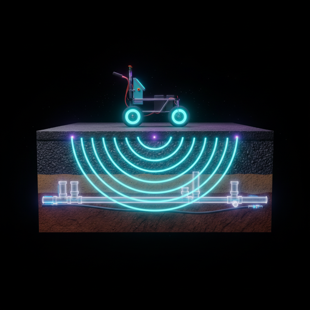
The ground is physically opaque — you cannot see through it. A feature, not a bug: This opacity forced us to deploy frontier sensing technologies that reveal what eyes never could.
Deep Sensing Research: Frontier Technologies for Underground Infrastructure Detection
Project: Making the Underground Visible -- be.liviu.ai Target Area: Wilmersdorfer Strasse, Charlottenburg, Berlin Date: 2026-03-25 Research Panel: 7 ultra-expert researchers (geophysics, remote sensing, quantum sensing, IoT/telecom, urban planning, satellite EO, data integration)
Executive Summary
Top 5 Actionable Technologies for Wilmersdorfer Strasse (Ranked by Feasibility)
| Rank | Technology | TRL | Time to Deploy | Est. Cost | Why |
|---|---|---|---|---|---|
| 1 | GPR (Ground Penetrating Radar) | 9 | Immediate | EUR 2K-15K (survey) | Gold standard for utility detection. Hire a Berlin-based GPR service provider for a single-day survey of Wilmersdorfer Str. Direct pipe/cable location data for the Three.js model. |
| 2 | Berlin Open Data (LiDAR + 3D Stadtmodell) | 9 | Immediate (free) | EUR 0 | Berlin's 3D mesh model (June 2025 flight), DGM1 terrain, LoD2 buildings available as free downloads in CityGML/OBJ/DXF. Direct Three.js integration via CityGML-to-glTF conversion. |
| 3 | InSAR / EGMS Satellite Subsidence | 8 | 1-2 weeks (free) | EUR 0 | European Ground Motion Service provides free mm-precision ground deformation data for Berlin. Overlay subsidence heatmap onto the Three.js model to infer underground stress zones. |
| 4 | Thermal Infrared Drone Survey | 8 | 2-4 weeks | EUR 3K-8K | Detect district heating leaks, sewer thermal signatures, and subsurface voids via thermal anomaly mapping. Berlin's 2,000+ km Fernwarme network passes through Charlottenburg. |
| 5 | infrest Leico Utility Data Portal | 9 | 1-2 weeks | EUR 0-500 | infrest's Leitungs-check-online portal provides utility line data from 18,600+ connected infrastructure operators. Official source for pipe/cable locations before excavation. |
Berlin-Specific Infrastructure Context
Wilmersdorfer Strasse sits atop:
- U7 tunnel (opened 1978, passes under the street before swinging under the Stadtbahn)
- BWB water network (part of 7,816 km pipe network, 275,000 building connections)
- BWB sewer network (part of 9,746 km system; Charlottenburg area likely combined sewer)
- BEW district heating (part of 2,000+ km network, largest in Western Europe)
- Stromnetz Berlin electricity (99% underground cables in Berlin)
- GASAG gas network
- Telecom (Deutsche Telekom, fiber, copper)
1. Fiber Optic DAS/DTS (Distributed Acoustic/Temperature Sensing)
Technology Principle
Distributed Acoustic Sensing (DAS) transforms standard fiber optic cables into dense arrays of virtual sensors by exploiting Rayleigh backscattering. A coherent laser pulse is sent down the fiber, and the backscattered light is analyzed for phase changes caused by acoustic vibrations or strain. Distributed Temperature Sensing (DTS) uses Raman scattering to measure temperature along the fiber. Together, they can detect leaks (acoustic signature + temperature anomaly), traffic vibrations, pipe bursts, and intrusions.
Key innovation: existing telecom dark fiber can be repurposed as sensors, turning Berlin's already-buried fiber infrastructure into a sensing network without new trenching.
Detection Capabilities
| Parameter | DAS | DTS |
|---|---|---|
| Range | Up to 100 km per interrogator unit | Up to 30 km |
| Spatial resolution | 0.5-10 m (gauge length dependent) | 0.25-2 m |
| Detection depth | Depends on fiber burial depth (typically 0.5-2 m for telecom) | Same |
| Sensitivity | Sub-nanometer strain; vibrations from footsteps detectable | 0.01 degC temperature resolution |
| Sampling rate | Up to 100 kHz (acoustic) | Minutes (steady-state) |
| Leak detection accuracy | 5 m pinpointing (DALI system demonstration) | 1-2 m for thermal anomalies |
Sources: OptaSense, Silixa, DALI Monitoring
Berlin-Specific Deployments & Data
No confirmed BWB or Berlin-specific fiber sensing pilot was found in public sources. However:
- The DALI system has demonstrated internal-fiber sensing on a 6 km, 1000 mm drinking water pipeline with 5 m accuracy leak detection (Pipeline Technology Conference)
- The Hamburg WAVE proto-network uses DAS on telecom fiber for seismic monitoring at DESY and University of Hamburg (arXiv 2511.17141)
- Deutsche Telekom operates extensive dark fiber in Berlin that could theoretically be leased for DAS sensing
Key Vendors & Products
| Vendor | Product | Specialty | HQ |
|---|---|---|---|
| OptaSense (Luna) | ODH4+ interrogator | Pipeline, traffic, seismic | UK |
| Silixa | iDAS, ULTIMA DTS | Infrastructure SHM, geotechnical | UK |
| Fotech (bp subsidiary) | Helios DAS | Pipeline, perimeter security | UK |
| AP Sensing | N45-series DTS/DAS | Water/wastewater pipelines | Germany (Boblingen) |
| DALI Monitoring | DALI internal fiber | Retrofittable pipeline sensing | Netherlands |
| Hertzinno | Optica series | Civil infrastructure | Israel |
Pricing: DAS interrogator units range EUR 80,000-250,000. Dark fiber lease in urban Germany approximately EUR 500-2,000/strand/mile/year. Total project cost for a 1 km pilot: EUR 100K-300K including equipment, fiber access, and integration.
Integration with Three.js Model
- DAS data is inherently linear (along-fiber distance). Convert fiber path coordinates to Three.js world coordinates using a known fiber route map.
- Acoustic events can be displayed as animated pulses along the fiber path.
- Temperature profiles can be visualized as color-coded tubes following pipe routes.
- Real-time streaming possible via WebSocket from DAS interrogator API to Three.js frontend.
- Library: iTowns (Three.js-based geospatial framework) supports WFS/WMS overlay.
TRL & Feasibility Rating
- TRL: 8-9 (commercial products deployed globally; urban telecom fiber DAS demonstrated)
- Wilmersdorfer Str. applicability: MEDIUM -- requires partnership with Deutsche Telekom or BWB for fiber access. High value if dark fiber routes along the street can be identified.
- Data integration: HIGH -- linear data maps directly to 3D pipe geometry.
- Recommendation: Medium-term (6-12 months). Pursue partnership with AP Sensing (German HQ) and Deutsche Telekom for a dark fiber DAS pilot on Wilmersdorfer Str.
2. LoRaWAN / IoT Underground Sensors
Technology Principle
Low-Power Wide-Area Network (LPWAN) sensors placed in manholes, utility vaults, and underground chambers transmit telemetry (water level, gas concentration, temperature, humidity, vibration, manhole cover status) over LoRaWAN at very low power consumption. Battery life of 5-10 years. LoRaWAN signals can penetrate from below heavy cast-iron manhole covers through dense urban environments.
Detection Capabilities
| Parameter | Value |
|---|---|
| Range | 2-15 km urban, depending on gateway density |
| Power | Ultra-low (10+ year battery life) |
| Data rate | 0.3-50 kbps (sufficient for telemetry) |
| Sensor types | Water level (ultrasonic), flow, gas (CH4, H2S, CO), temperature, humidity, accelerometer (cover displacement), vibration |
| Update interval | Configurable: 1 min to 24 hr |
| Penetration | Through manhole covers, 1-3 m soil |
Berlin-Specific Deployments & Data
- Berlin Smart City Strategy ("Gemeinsam Digital: Berlin"): Phase B (2022-2026) includes 5 pilot projects in areas including water management and data use in emergencies. The strategy runs until December 2026 with federal funding (smart-city-berlin.de).
- Stadtwerke Giessen (German public utility) has deployed WILSEN.sonic battery-operated IoT ultrasonic sensors with LoRaWAN for sewer level monitoring (Semtech Blog).
- Smart City Solutions (German company) delivers turn-key LoRaWAN networks for municipal utilities (smart-city-solutions.de).
- The Things Network Berlin community operates public LoRaWAN gateways across Berlin.
- No confirmed Berlin underground sensor deployment found in public sources for Charlottenburg specifically.
Key Vendors & Products
| Vendor | Product | Application | Price Range |
|---|---|---|---|
| YZ Systems / Aircom | LoRaWAN sewer nodes | Sewer level monitoring | EUR 200-500/sensor |
| WILSEN (Pepperl+Fuchs) | WILSEN.sonic | Ultrasonic level in manholes | EUR 300-600/sensor |
| Decentlab | DL-MBX, DL-SHT35 | Multi-parameter environmental | EUR 250-800/sensor |
| Semtech | LoRa chipsets | Enabling technology | Chipset level |
| Smart City Solutions | Turnkey LoRaWAN | Full network deployment | Project-based |
| Kerlink | LoRaWAN gateways | Network infrastructure | EUR 500-3,000/gateway |
Integration with Three.js Model
- Each sensor is a georeferenced point. Place 3D marker icons at sensor locations in the Three.js scene.
- Real-time data via MQTT/HTTP API from LoRaWAN network server (e.g., The Things Stack, ChirpStack).
- Visualize water levels as animated fill indicators inside manhole/vault 3D models.
- Gas concentrations as color-coded halos. Temperature as heat indicators.
- Dashboard overlay with time-series charts (D3.js integrated with Three.js).
TRL & Feasibility Rating
- TRL: 9 (fully commercial, deployed in German cities)
- Wilmersdorfer Str. applicability: HIGH -- manholes and utility vaults exist along the entire street. Straightforward to deploy 10-20 sensors.
- Data integration: HIGH -- point data with real-time telemetry.
- Cost for pilot: EUR 5K-15K for 20 sensors + 2 gateways + 1-year connectivity.
- Recommendation: Quick win. Deploy a LoRaWAN sensor network in existing manholes along Wilmersdorfer Str. within 2-4 weeks.
3. Ground Penetrating Radar (GPR)
Technology Principle
GPR transmits short pulses of electromagnetic energy (radio waves) into the ground via an antenna. When these pulses encounter a boundary between materials with different dielectric properties (e.g., soil/pipe, soil/void, soil/cable), part of the energy is reflected back. The return signal's travel time and amplitude reveal the depth and nature of subsurface objects. Dual-frequency systems (e.g., 300/800 MHz) provide both deep penetration and high resolution simultaneously.
Detection Capabilities
| Parameter | 300 MHz Antenna | 800 MHz Antenna | Dual-Freq |
|---|---|---|---|
| Depth | Up to 6-8 m | Up to 2-3 m | Both |
| Resolution | ~15 cm vertical | ~5 cm vertical | Both |
| Material detection | Metal, plastic, concrete, voids | Same + smaller targets | Full range |
| Speed | Walking pace (3-5 km/h) | Same | Same |
| Lane width | 0.4-0.6 m per pass | Same | Same |
Detection targets: water pipes (metal and PVC), gas pipes, electrical conduits, fiber/telecom ducts, sewer pipes, voids/cavities, tunnel structures, rebar in concrete.
Sources: GSSI, ImpulseRadar, GFZ Potsdam
Berlin-Specific Deployments & Data
- GPR utility surveys (Leitungsortung) are standard practice in Berlin before any excavation work, per German regulations.
- DIN 18920 (Schutz von Baumen, Pflanzenbestanden und Vegetationsflachen bei Baumassnahmen) and DIN 4124 (Excavation) reference utility detection requirements.
- Multiple Berlin-based GPR service providers operate (search "Leitungsortung Berlin" or "Leitungssuche Berlin").
- GFZ Helmholtz Centre Potsdam maintains GPR research infrastructure near Berlin (GFZ GPR).
- Recent AI research: a dataset of 2,239 radargram images from GPR surveys in urban environments for deep learning utility detection (ScienceDirect).
Key Vendors & Products
| Vendor | Product | Key Feature | Purchase Price |
|---|---|---|---|
| ImpulseRadar | PinPointR | Dual-freq (400/800 MHz), wireless, 7hr battery | EUR 25K-50K |
| GSSI | UtilityScan Pro / DF | Dual-freq (300/800 MHz), SIR 4000 platform | EUR 30K-60K |
| Proceq (Screening Eagle) | GP8800 | Ultra-wideband stepped frequency, 3D | EUR 15K-35K |
| Radiodetection | LMX series | Integrated with cable/pipe locator | EUR 20K-40K |
| MALA (Guideline Geo) | ProEx, Easy Locator | Research-grade to utility-grade | EUR 20K-80K |
Rental: ~EUR 250/day for basic cart; EUR 1,000-4,000/month for advanced systems. Professional survey service: EUR 1,500-5,000 for a single-street survey (500-800 m like Wilmersdorfer Str.).
Sources: GPR Rental Rates, GPRS Cost Guide
Integration with Three.js Model
- GPR outputs radargrams (B-scans) that are 2D depth slices. Multiple parallel passes create 3D volumes (C-scans).
- Post-processing: Convert detected pipe/cable hyperbolas to XYZ coordinates using GPR software (e.g., RADAN, ReflexW).
- Export pipe centerlines as GeoJSON or CSV, import into Three.js as 3D tube geometries.
- Radargram cross-sections can be displayed as textured planes in the 3D scene for verification.
- Tools: three-geo for coordinate transformation.
TRL & Feasibility Rating
- TRL: 9 (mature, standardized, regulated)
- Wilmersdorfer Str. applicability: HIGHEST -- immediate deployment, well-suited to the pedestrian zone.
- Data integration: HIGH -- direct pipe/cable geometry for Three.js.
- Recommendation: QUICK WIN #1. Commission a professional GPR survey of Wilmersdorfer Str. Cost: EUR 2K-5K. Timeline: 1-2 days of fieldwork, 1 week processing.
4. InSAR / Satellite Interferometry
Technology Principle
Interferometric Synthetic Aperture Radar (InSAR) compares SAR images of the same area taken at different times to detect millimeter-scale ground surface deformation. Persistent Scatterer InSAR (PS-InSAR) tracks individual reflectors (buildings, poles, infrastructure) over time to build deformation time series. Ground subsidence can indicate: underground void collapse, water main leaks (soil washout), tunnel settlement, or construction-induced movement.
Detection Capabilities
| Parameter | Sentinel-1 (C-band) | TerraSAR-X (X-band) |
|---|---|---|
| Spatial resolution | 5x20 m (IW mode) | 1-3 m (StripMap/SpotLight) |
| Temporal resolution | 6 days (constellation) | 11 days |
| Deformation precision | 1-2 mm/year (PS-InSAR) | <1 mm/year |
| Coverage | Global, free | Tasked, commercial |
| Data access | Copernicus (free) | DLR (proposal-based or commercial) |
| Point density (urban) | 1,000-10,000/km2 | 10,000-100,000/km2 |
Sources: Nature Review, DLR TerraSAR-X
Berlin-Specific Deployments & Data
- European Ground Motion Service (EGMS): Free, pan-European InSAR ground motion data derived from Sentinel-1. Berlin data available at egms.land.copernicus.eu. Provides Basic (measurement points with velocity and time series) and Calibrated (ortho-referenced) products. Data from 2018-2022 available for download (EGMS Portal).
- German Ground Motion Service (BBD / Bodenbewegungsdienst Deutschland): Operated by BGR (Federal Institute for Geosciences and Natural Resources). Provides Germany-specific InSAR ground motion data complementary to EGMS (Springer comparison study).
- TerraSAR-X: German satellite (DLR), operational, with enough consumables for operations through at least 2026. High-resolution X-band data available for Berlin through DLR science proposals or commercial channels (eoPortal).
- Sentinel-1C: First InSAR dataset released February 2025, extending the Sentinel-1 constellation (Copernicus).
Key Vendors & Products
| Vendor | Service | Specialty |
|---|---|---|
| TRE ALTAMIRA (CLS Group) | SqueeSAR, InSAR analysis | EGMS processing, urban monitoring |
| Detektia | InSAR monitoring platform | Infrastructure monitoring |
| geokinesia | InSAR deformation maps | Urban subsidence |
| SkyGeo | InSAR monitoring | Infrastructure, construction |
| DLR | TerraSAR-X data | Science/commercial proposals |
Integration with Three.js Model
- EGMS data exports as CSV with lat/lon/velocity/time-series per persistent scatterer point.
- Import PS points into Three.js as colored spheres or heat-mapped ground overlay.
- Color scale: green (stable) to red (subsiding) based on mm/year velocity.
- Time-series animation: show ground motion evolution over years.
- Overlay on Berlin 3D Stadtmodell buildings to identify structures with differential settlement.
TRL & Feasibility Rating
- TRL: 8-9 (operational services, free data)
- Wilmersdorfer Str. applicability: HIGH -- dense urban area = excellent PS point density. Free EGMS data available immediately.
- Data integration: HIGH -- point cloud with attributes maps directly to Three.js.
- Recommendation: QUICK WIN #2. Download EGMS data for Charlottenburg. Overlay on Three.js model. Cost: EUR 0. Timeline: 1-2 days of processing.
5. Thermal Infrared
Technology Principle
Thermal infrared (TIR) cameras detect emitted radiation in the 8-14 micrometer wavelength range, measuring surface temperature variations. Underground hot-water pipes (district heating), steam lines, and sewers create thermal signatures detectable at the surface. Leaks, insulation failures, and shallow infrastructure produce temperature anomalies of 0.5-5 degC that are invisible to the eye but clear in thermal imagery. Drone-mounted TIR cameras enable rapid, high-resolution surveys of entire streets.
Detection Capabilities
| Parameter | Value |
|---|---|
| Temperature sensitivity (NETD) | 0.03-0.05 degC (cooled cameras), 0.05-0.1 degC (uncooled) |
| Spatial resolution | 5-20 cm/pixel at 50 m flight altitude |
| Coverage rate | 10-50 hectares/hour via drone |
| Detection depth (indirect) | Surface thermal anomalies from pipes at 0.5-3 m depth |
| Best conditions | Pre-dawn surveys, dry weather, autumn/winter (max thermal contrast) |
| ML detection rate | 98.6% for district heating leaks (UAV + ML pipeline) |
Sources: ScienceDirect UAV ML study, Vertex Access case study, Frontiers drone leak concepts
Berlin-Specific Deployments & Data
- BEW Berliner Energie und Warme (formerly Vattenfall Warme Berlin, acquired by State of Berlin May 2024) operates the 2,000+ km district heating network -- the largest in Western Europe. The network runs through Charlottenburg. BEW plans to invest EUR 3.3 billion in the network (berlin.de).
- District heating pipe routes in Charlottenburg are not publicly available as open data but are accessible via the infrest Leico portal for construction planning.
- Thermal drone surveys are a proven method for Fernwarme leak detection in Germany, though no specific Berlin deployment was found in public sources.
- LiDAR intensity has been recently demonstrated for detecting wet surfaces from underground water leaks (Tandfonline 2025 study).
Key Vendors & Products
| Vendor | Product/Service | Application |
|---|---|---|
| DJI | Matrice 350 RTK + Zenmuse H30T | Thermal drone survey |
| FLIR (Teledyne) | Vue TZ20 / Duo Pro R | Drone-mounted thermal cameras |
| Autel | EVO Max 4T | Quad-sensor drone (thermal + visual + IR + laser) |
| Anvil Labs | Thermal analytics platform | AI pipeline leak detection |
| Vertex Access | Thermal drone survey services | District heating leak detection (UK) |
Cost: Drone thermal survey of Wilmersdorfer Str. (800 m): EUR 3K-8K for a professional service. Equipment rental: EUR 500-1,500/day for drone + thermal camera.
Integration with Three.js Model
- Thermal orthomosaic (georeferenced thermal image) overlaid as ground texture in Three.js.
- Hot spots rendered as glowing markers or heat-map overlays on the street surface.
- Combine with pipe route data to correlate thermal anomalies with specific utility lines.
- Time-lapse comparison (seasonal surveys) visualized as slider animation.
TRL & Feasibility Rating
- TRL: 8-9 (mature technology, proven for district heating)
- Wilmersdorfer Str. applicability: HIGH -- BEW district heating routes through the area, dense utility zone.
- Data integration: HIGH -- raster imagery maps directly to Three.js ground plane.
- Note: Drone flights in Berlin require EASA Open Category registration and, for urban areas, Specific Category authorization from LBA. Wilmersdorfer Str. is in a controlled airspace zone near Berlin-Tegel (though the airport is closed, airspace restrictions may still apply).
- Recommendation: Medium-term. Schedule a pre-dawn thermal drone survey in autumn 2026. Partner with BEW for ground truth validation.
6. WiFi / RF Tomography
Technology Principle
RF tomography uses the attenuation, scattering, and travel-time variations of radio frequency signals passing through the ground to reconstruct subsurface images. In theory, existing WiFi access points, cellular base stations, or purpose-deployed transmitters on the surface can be used to create a distributed sensor network. The signals that penetrate the ground interact with underground objects (voids, pipes, tunnels), and tomographic inversion algorithms reconstruct a 3D image of subsurface dielectric properties.
Detection Capabilities
| Parameter | Value |
|---|---|
| Frequency range | 50-500 MHz (purpose-built), 2.4/5 GHz (WiFi) |
| Detection depth | 1-10 m (frequency dependent; lower freq = deeper) |
| Resolution | 0.5-2 m (depends on array density) |
| Targets | Voids, tunnels, large pipes (>0.3 m diameter) |
| Limitation | High WiFi frequencies (2.4/5 GHz) have very limited ground penetration (<0.5 m in wet soil) |
Sources: IEEE RF Tomography, ProQuest dissertation, Nature Scientific Reports 2025
Berlin-Specific Deployments & Data
- No known Berlin deployments for underground infrastructure detection using RF/WiFi tomography.
- TU Berlin has strong radar and signal processing research groups, but no specific underground WiFi tomography project was identified.
- The technology remains primarily academic, with most demonstrations in military tunnel detection scenarios (e.g., DTIC/US Army-funded research).
- WiFi-based Radio Tomography Imaging (RTI) using CNN models and WiFi RSSI has been demonstrated for indoor localization (2025 Nature study), but not for underground utility detection.
Key Vendors & Products
No commercial vendors offer RF tomography specifically for urban underground infrastructure detection. This is a purely research-stage technology.
Integration with Three.js Model
- If implemented: 3D volumetric data (voxel grid) could be rendered as semi-transparent volumes or isosurfaces in Three.js.
- Would require custom WebGL shaders for volumetric rendering.
TRL & Feasibility Rating
- TRL: 3-4 (laboratory demonstrations, military research prototypes)
- Wilmersdorfer Str. applicability: LOW -- high WiFi frequencies cannot penetrate urban ground effectively. Would require purpose-built low-frequency system.
- Data integration: MEDIUM (if data existed)
- Recommendation: Long-term research only. Not practical for the project in its current state. Monitor TU Berlin publications for breakthroughs.
7. Acoustic / Seismic Methods
Technology Principle
Multiple acoustic and seismic techniques apply to underground infrastructure:
- Acoustic Leak Detection: Correlators listen to sound propagation along pipes to triangulate leak positions. Water escaping under pressure creates characteristic acoustic signatures (50 Hz - 3 kHz).
- Acoustic Emission (AE): Passive listening for sounds generated by pipe stress, corrosion, or leaks.
- Passive Ambient Noise Tomography (ANT): Uses background urban noise (traffic, construction, footsteps) as a seismic source. Cross-correlation of noise recorded at multiple sensors reveals shear-wave velocity structure, mapping underground layers and objects.
- MASW/MAPS: Multichannel Analysis of Surface Waves uses surface wave dispersion to profile subsurface shear-wave velocity down to 100 m depth.
- DAS-based ambient noise imaging: Using fiber optic DAS to record urban ambient noise for subsurface tomography.
Detection Capabilities
| Method | Depth | Resolution | Application |
|---|---|---|---|
| Acoustic correlator (Echologics) | Along pipe (km range) | 1 m (location accuracy) | Leak pinpointing |
| Acoustic Emission | Along pipe | 0.3 m (1 foot) at 25 ft sensor spacing | Leak detection, pipe condition |
| Ambient Noise Tomography | 5-100 m | 5-50 m (depends on array) | Subsurface velocity model |
| Passive MASW | 1-30 m | 2-10 m | Shallow stratigraphy |
| DAS ambient noise | 1-50 m | 1-5 m (high spatial resolution) | Subsurface imaging |
Sources: Echologics LeakFinder-ST, ScienceDirect AE method, GeoScienceWorld DAS subsurface imaging
Berlin-Specific Deployments & Data
- BWB likely uses acoustic leak detection internally (standard water utility practice), though no public documentation found.
- IMS (Institute of Mine Seismology) offers ambient noise tomography services globally, including for urban applications (IMS).
- DAS-based urban subsurface imaging demonstrated in downtown Reno, NV using telecom fiber -- directly transferable to Berlin (Seismic Record 2025).
- Recent 2025 review paper: "Geophysical Exploration of Urban Underground Space: Current Status, Trends, and Future Directions" covers passive seismic methods for urban settings (ScienceDirect).
Key Vendors & Products
| Vendor | Product | Application | Price |
|---|---|---|---|
| Echologics (Mueller Water) | LeakFinder-ST | Acoustic leak correlation | EUR 15K-30K system |
| Gutermann | Zonescan Alpha | Permanent acoustic monitoring | EUR 200-500/sensor node |
| FAST (U. Auckland) | Ambient noise tomography | Research method | Academic collaboration |
| IMS | ANT survey services | Subsurface velocity model | Project-based |
| Silixa (with DAS) | iDAS + ANT processing | DAS-based subsurface imaging | Part of DAS system |
Integration with Three.js Model
- Leak locations: point markers with audio playback of leak signature.
- ANT velocity models: 3D volumetric slice displays (velocity cross-sections as textured planes).
- MASW profiles: 2D depth sections along survey lines, rendered as vertical planes in the 3D scene.
- Pipe condition data: color-coded pipe segments (good/degraded/critical).
TRL & Feasibility Rating
- TRL: 7-9 (leak detection = TRL 9; ambient noise tomography = TRL 6-7)
- Wilmersdorfer Str. applicability: HIGH for leak detection; MEDIUM for ambient noise tomography (requires dense sensor array).
- Data integration: MEDIUM-HIGH
- Recommendation: Quick win for leak detection (hire Echologics-equipped contractor). Medium-term for ANT (partner with GFZ Potsdam or university research group).
8. Quantum Gravity Gradiometry
Technology Principle
Quantum gravity gradiometers use atom interferometry to measure the gradient of the gravitational field with extreme precision. Two clouds of ultracold rubidium atoms are released in free-fall inside a vacuum chamber, separated vertically by ~1 m. Laser pulses create simultaneous atom interferometers that measure the difference in gravitational acceleration between the two heights. This differential measurement is sensitive to local density variations (voids, pipes, tunnels) while rejecting common-mode vibration noise that plagues conventional gravimeters.
The landmark 2022 Nature paper demonstrated the first outdoor field detection of an underground tunnel using this technology.
Detection Capabilities
| Parameter | Value |
|---|---|
| Sensitivity | 20 Eotvos (20 x 10^-9 s^-2) statistical uncertainty |
| Spatial resolution | 0.5 m (survey step size demonstrated) |
| Detection demonstrated | 2 m x 2 m tunnel at 1.89 m depth, SNR = 8 |
| Horizontal localization | +/- 0.19 m |
| Depth estimation | 1.89 m (-0.59/+2.3 m uncertainty) |
| Survey speed | Currently slow (minutes per station); improving |
| Portability | Currently vehicle-sized; rapidly miniaturizing |
Source: Nature 2022 -- "Quantum sensing for gravity cartography", University of Birmingham
Berlin-Specific Deployments & Data
- No Berlin-specific quantum gravity deployments found.
- UK Gravity Pioneer project (UK Ministry of Defence funded) drove the Birmingham demonstration and continues to develop applications including utility detection (gravity-pioneer.org).
- Exail (formerly iXblue/Muquans) manufactures the Absolute Quantum Gravimeter (AQG) for field deployment. Currently installed on Mount Etna for geophysical monitoring.
- A 2025 paper in ScienceDirect discusses "Application of gravity gradient measurement in the detection of urban underground space" (ScienceDirect).
- EPJ Quantum Technology (2025) review: "Quantum gravity gradiometry for future mass change science" (Springer).
Key Vendors & Products
| Vendor | Product | Status |
|---|---|---|
| Exail (Muquans) | AQG-A10 Absolute Quantum Gravimeter | Commercial, field-deployable |
| ColdQuanta (Infleqtion) | Quantum sensors | Defense/research prototypes |
| University of Birmingham | Gravity gradiometer | Research prototype |
| AOSense | Portable atom interferometer | US defense applications |
| M Squared Lasers | Laser systems for atom interferometry | Component supplier |
Pricing: The AQG system costs approximately EUR 500K-1M. Not available for short-term rental. Research collaboration is the viable path.
Integration with Three.js Model
- Gravity gradient data: 2D map of gravity anomalies overlaid on the ground surface.
- Inversion results: 3D density model showing underground voids and mass concentrations.
- Render as volumetric anomaly indicators (colored blobs at estimated depths).
- Particularly powerful for detecting unknown voids not in any utility records.
TRL & Feasibility Rating
- TRL: 5-6 (first outdoor field test demonstrated 2022; not yet commercial for urban surveys)
- Wilmersdorfer Str. applicability: LOW-MEDIUM -- survey speed is too slow for routine use today, but would uniquely detect unknown voids.
- Data integration: MEDIUM -- requires inversion processing before 3D visualization.
- Recommendation: Long-term (>12 months). Monitor UK Gravity Pioneer commercialization timeline. Consider research partnership with University of Birmingham or Exail for a Berlin pilot (strong EU quantum research funding available).
9. Muon Tomography
Technology Principle
Cosmic ray muons are subatomic particles produced when cosmic radiation collides with Earth's atmosphere. They rain down continuously at a rate of ~10,000/m2/minute at sea level. Muons penetrate deeply through matter but are absorbed in proportion to material density. By placing detectors below or beside a target and measuring the muon flux from multiple directions, density variations can be reconstructed -- revealing voids, tunnels, dense structures, and material boundaries underground.
This is the same technique that discovered the "Big Void" in the Great Pyramid of Giza (ScanPyramids project, 2017).
Detection Capabilities
| Parameter | Value |
|---|---|
| Penetration depth | 8 m to 400+ m (depending on overburden density) |
| Spatial resolution | 5 mm hit resolution; angular resolution 15-40 mrad |
| Detection targets | Voids, tunnels, dense objects, material boundaries |
| Exposure time | Minutes (optimized) to weeks (traditional) |
| Detector size | 0.3 m2 (portable HAWL) to several m2 (fixed installations) |
| Tunnel length accuracy | 6.0% demonstrated |
| Cost of basic detector | As low as USD 100 (MIT design) to EUR 50K+ (professional) |
Sources: Nature Scientific Reports -- 3D Muography, phys.org 2025 -- muon urban mapping, arxiv 2503.23558 -- civil structures
Berlin-Specific Deployments & Data
- No Berlin-specific muon tomography deployment found.
- Jerusalem field test (2025): Confirmed muon tomography can effectively map hidden underground spaces in urban environments (phys.org).
- Muon Systems (Estonia-UK) offers non-destructive testing of civil infrastructure using muography (muon.systems).
- Muon Solutions (Finland) focuses on mining and industrial applications.
- Laser-plasma accelerators (2025 innovation) may dramatically reduce scan times by generating on-demand muon beams.
- Application to the Wilmersdorfer Str. U7 tunnel: a detector placed in the U-Bahn station could potentially map the surrounding soil structure and detect unknown voids/utilities around the tunnel.
Key Vendors & Products
| Vendor | Product | Application | Price |
|---|---|---|---|
| Muon Systems (GScan) | Portable muon detector | Infrastructure NDE | Project-based |
| Muon Solutions (Finland) | Muography service | Mining, civil | Project-based |
| Decision Sciences | Multi-Mode Passive Detection System | Security, cargo scanning | USD 1M+ |
| ScanPyramids team (CEA, Nagoya U) | Custom detectors | Archaeological/civil | Research |
| HAWL (Korea) | Portable muon detector | Fast scanning (0.3 m2) | Research prototype |
Integration with Three.js Model
- Muon tomography produces 3D density maps (voxel grids).
- Render as semi-transparent isosurfaces in Three.js (voids in blue, dense objects in red).
- Particularly valuable for mapping the U7 tunnel structure and surrounding soil.
- Animation: show muon flux pathways as particle trails in the 3D scene.
TRL & Feasibility Rating
- TRL: 5-7 (archaeological/mining use = TRL 7; urban infrastructure = TRL 5)
- Wilmersdorfer Str. applicability: LOW-MEDIUM -- could map U7 tunnel surroundings but requires detector placement in the station and weeks of exposure.
- Data integration: MEDIUM -- volumetric data requires processing before visualization.
- Recommendation: Long-term research (>12 months). Contact Muon Systems (Estonia-UK) for feasibility assessment. Could be a unique demonstration project -- "muon tomography of a Berlin U-Bahn station."
10. LiDAR + Photogrammetry
Technology Principle
While LiDAR and photogrammetry are primarily surface technologies, they provide critical indirect evidence of underground infrastructure:
- Manhole cover mapping: Automatic detection and georeferencing of all manhole covers, valve covers, and access points.
- Surface settlement detection: Sub-centimeter elevation changes between surveys indicate subsurface movement.
- Vegetation stress: Anomalous vegetation patterns (NDVI) can indicate underground leaks or gas emissions.
- 3D surface context model: The above-ground 3D environment into which underground data is integrated.
Berlin's 3D Stadtmodell provides the foundation layer for the Three.js visualization.
Detection Capabilities
| Parameter | Airborne LiDAR | Terrestrial LiDAR | UAV Photogrammetry |
|---|---|---|---|
| Point density | 4-20 pts/m2 (ALS) | 1,000-10,000 pts/m2 | 100-1,000 pts/m2 |
| Elevation accuracy | +/- 5-15 cm | +/- 1-3 mm | +/- 2-5 cm |
| DGM resolution | 1 m grid (Berlin DGM1) | N/A (local) | 2-5 cm |
| Coverage | City-wide | Street-level | Street to neighborhood |
| Cost | Included in Berlin open data | EUR 2K-10K/survey | EUR 1K-5K/survey |
Berlin-Specific Deployments & Data
This is a goldmine for the project. Berlin provides extensive free open geodata:
- Berlin 3D Stadtmodell (3D City Model): Award-winning open data. Current 3D mesh model based on June 2025 flight survey. LoD2 buildings available as CityGML. Free download from Berlin Business Location Center (Berlin Open Data).
- 3DCityLoader: Tool to convert Berlin's open geodata into DXF, STL, OBJ formats -- directly usable in Three.js via glTF/OBJ import (3DCityLoader).
- DGM1 (Digital Terrain Model): 1 m grid spacing LiDAR-derived terrain from Airborne Laser Scanning (Berlin Open Data LiDAR tag).
- Geoportal Berlin: Central portal for WMS/WFS geospatial services (gdi.berlin.de).
- Berlin Environmental Atlas (Umweltatlas): Geoservices (WMS, WFS, Atom feed) for soil, water, vegetation data (berlin.de/umweltatlas).
- OpenStreetMap Berlin: Downloadable in PBF and Shapefile formats from Geofabrik. Includes mapped manholes, utility lines, and infrastructure.
Key Data Products for Three.js
| Dataset | Format | Access | Use |
|---|---|---|---|
| 3D City Model LoD2 | CityGML, OBJ, STL | Free download | Building context |
| DGM1 Terrain | GeoTIFF, XYZ | Free download | Ground surface |
| DOM (Surface Model) | GeoTIFF | Free download | True surface incl. buildings |
| Orthophotos | WMS/WMTS | Free service | Texture mapping |
| OSM Berlin | PBF, SHP | Free download | Manhole positions, streets |
| Environmental Atlas | WMS/WFS | Free service | Soil, water table |
Integration with Three.js Model
This is the foundation layer for the entire project:
- Download Berlin LoD2 buildings for Wilmersdorfer Str. area via 3DCityLoader (OBJ format).
- Import DGM1 terrain as Three.js PlaneGeometry with displacement map.
- Apply orthophoto texture to terrain.
- Place manhole markers from OSM data.
- All underground data from other technologies layers beneath this surface model.
Libraries: iTowns, three-geo, OpenGlobus
TRL & Feasibility Rating
- TRL: 9 (operational, free, comprehensive)
- Wilmersdorfer Str. applicability: HIGHEST -- data already exists and is freely available.
- Data integration: HIGHEST -- direct 3D formats (OBJ, CityGML).
- Recommendation: QUICK WIN #0 (do this first). Download all Berlin open geodata for the Charlottenburg area today. This forms the 3D context into which all other data layers are integrated.
11. Satellite-Based Leak Detection & Novel Methods
Technology Principle
This category covers several emerging and complementary technologies:
- ASTERRA (formerly Utilis) -- SAR-based water leak detection: Uses L-band SAR satellite data to detect the spectral signature of treated drinking water in soil. Algorithm distinguishes potable water leaks from natural moisture. Detects leaks as small as 0.5 L/min.
- GHGSat -- Methane detection from space: Fleet of 16 satellites using shortwave infrared (SWIR) spectroscopy to detect methane at 25 x 25 m resolution, identifying leaks as small as ~100 kg/hr. Applicable to urban gas infrastructure.
- Electromagnetic Induction (FDEM): Ground-based sensors that induce eddy currents in metallic subsurface objects. Used alongside GPR for comprehensive utility mapping.
- Multi-physics fusion: Combining GPR + EMI + magnetic gradiometry + acoustic sensors for comprehensive underground utility detection. Growing market trend.
Detection Capabilities
| Technology | Detection Target | Resolution | Depth |
|---|---|---|---|
| ASTERRA SAR | Water leaks (potable) | ~100 m footprint, 5 m pinpointing | 0.5-8 m |
| GHGSat | Methane gas leaks | 25 x 25 m | Surface/atmospheric |
| FDEM | Metallic pipes/cables | 0.1-0.5 m | 1-6 m |
| Multi-physics fusion | All utility types | 0.05-0.5 m | 1-8 m |
Berlin-Specific Deployments & Data
- ASTERRA: Expanding globally. New Mexico awarded a 4-year statewide contract (Jan 2026). Phase 1 (May 2025): 82 leaks found, 240 GPM water loss reduction (WaterWorld). No confirmed Berlin/BWB deployment, but Berlin's water loss challenges make it a candidate.
- GHGSat: 16 satellites operational. 25 m resolution enables detection of individual buildings/pipes leaking methane. Berlin's GASAG gas network could be monitored. Madrid landfill demonstration in 2025 (phys.org).
- Underground Utility Mapping Market: Valued at USD 1.6 billion (2025), growing at 10% CAGR to USD 3.4 billion by 2033. EMI dominates, GPR growing fastest (Market Research Future).
- Multi-sensor fusion: Research demonstrates combining GPR, EMI, magnetic gradiometry, passive magnetic fields, and vibro-acoustics for comprehensive utility detection (Academia).
- Open Infrastructure Map: Free visualization of global electricity, telecom, oil, and gas infrastructure from OpenStreetMap (openinframap.org).
Key Vendors & Products
| Vendor | Technology | Product | Price Range |
|---|---|---|---|
| ASTERRA | SAR leak detection | Recover, MasterPlan, EarthWorks | Subscription-based (est. EUR 5-20K/year) |
| GHGSat | SWIR methane | DATA.SAT, SPECTRA | Commercial, tasked |
| Geonics | FDEM | EM31, EM34, EM38 | EUR 15K-40K |
| Geoscanners | Multi-sensor | Custom arrays | Project-based |
| Ticinum Aerospace | Satellite + AI | Deep Property (building analytics) | Subscription |
| Satellogic | High-res imagery | NewSat constellation | Commercial |
Integration with Three.js Model
- ASTERRA data: Leak probability heatmap overlaid on ground surface (GeoJSON polygons).
- GHGSat: Methane plume visualization as animated particle systems above the ground.
- FDEM: Conductivity map as color-coded ground overlay (metallic objects = high conductivity).
- Multi-physics fusion: Combined confidence map showing utility locations with certainty levels.
TRL & Feasibility Rating
- TRL: 7-9 (ASTERRA = TRL 8; GHGSat = TRL 8; FDEM = TRL 9; multi-physics fusion = TRL 7)
- Wilmersdorfer Str. applicability: MEDIUM-HIGH -- ASTERRA could identify leaks in BWB network; GHGSat for GASAG gas monitoring; FDEM as complement to GPR.
- Data integration: HIGH for all -- standard geospatial outputs.
- Recommendation: Medium-term. Contact ASTERRA and GHGSat for pilot proposals. Include FDEM in any GPR survey as a complementary method.
Quick Wins (Available Today,
#
Action
Cost
Timeline
Data for Three.js
1
Download Berlin 3D Stadtmodell (LoD2 buildings, DGM1 terrain, orthophotos)
EUR 0
1 day
OBJ/CityGML buildings, GeoTIFF terrain
2
Download EGMS InSAR data for Charlottenburg
EUR 0
1-2 days
CSV point cloud with subsidence velocities
3
Extract OSM underground data (manholes, utility lines, U-Bahn routes)
EUR 0
1 day
GeoJSON points and lines
4
Query infrest Leico portal for utility line data on Wilmersdorfer Str.
EUR 0-200
1-2 weeks
PDF/DXF utility plans
5
Commission GPR survey of Wilmersdorfer Str.
EUR 2K-5K
1-2 weeks
Pipe/cable XYZ coordinates
6
Query Stromnetz Berlin Open Data for electricity grid data
EUR 0
1 day
GeoJSON/WMS
7
Check Open Infrastructure Map for existing mapped utilities
EUR 0
1 hour
OSM data overlay
8
Download Berlin Environmental Atlas soil/water table data
EUR 0
1 day
WMS/WFS layers
Medium-Term (6-12 Months, Partnerships Needed)
#
Action
Est. Cost
Partners
Value
1
LoRaWAN sensor network in Wilmersdorfer Str. manholes (20 sensors)
EUR 5K-15K
Smart City Solutions, The Things Network Berlin
Real-time underground telemetry
2
Thermal infrared drone survey (pre-dawn, autumn)
EUR 3K-8K
Licensed drone operator, BEW
District heating + sewer thermal map
3
ASTERRA satellite water leak scan of Charlottenburg
EUR 5K-20K
ASTERRA, BWB
Leak probability map
4
Dark fiber DAS pilot on Wilmersdorfer Str.
EUR 100K-300K
AP Sensing, Deutsche Telekom, BWB
Continuous acoustic monitoring
5
Ambient noise tomography study with GFZ Potsdam
EUR 20K-50K
GFZ Potsdam, university partner
Subsurface velocity model
6
GHGSat gas leak scan of Charlottenburg
EUR 10K-30K
GHGSat, GASAG
Methane leak locations
7
Multi-physics GPR + FDEM + magnetics survey
EUR 8K-20K
Specialized geophysics contractor
Comprehensive utility map
Long-Term / Research (>12 Months)
#
Technology
Readiness
Path Forward
1
Quantum gravity gradiometry
TRL 5-6
Contact University of Birmingham / Gravity Pioneer for Berlin pilot proposal. Apply for EU quantum technology funding.
2
Muon tomography of U7 station
TRL 5
Contact Muon Systems (Estonia-UK) for feasibility study. Place detector in U-Bahn station.
3
RF/WiFi tomography
TRL 3-4
Monitor TU Berlin research. Not ready for deployment.
4
Full-coverage DAS network (city-scale)
TRL 7-8
Requires BWB/BEW partnership and significant capital. Model after Hamburg WAVE network.
5
AI-integrated multi-sensor fusion platform
TRL 6-7
Combine all data sources into unified AI-driven subsurface model. Research opportunity.
Berlin Open Data Sources Discovered
Source
URL
Data Type
Format
Cost
Berlin 3D Stadtmodell
businesslocationcenter.de/downloadportal
LoD2 buildings, 3D mesh
CityGML, OBJ, STL, DXF
Free
3DCityLoader
3dcityloader.com
Converted 3D models
DXF, STL, OBJ
Free
Geoportal Berlin
gdi.berlin.de
WMS/WFS geodata services
WMS, WFS
Free
Berlin Open Data / LiDAR
daten.berlin.de (LiDAR tag)
DGM1, DOM
GeoTIFF, XYZ
Free
Berlin Environmental Atlas
berlin.de/umweltatlas
Soil, water, vegetation
WMS, WFS, PDF
Free
EGMS Ground Motion
egms.land.copernicus.eu
InSAR subsidence
CSV, GeoPackage
Free
German Ground Motion (BBD)
BGR portal
InSAR subsidence (Germany)
Web viewer
Free
Sentinel-1 SAR Data
dataspace.copernicus.eu
Raw SAR imagery
SAFE format
Free
ODIS Berlin
daten.odis-berlin.de
Curated Berlin geodata
CSV, GeoJSON, SHP
Free
OpenStreetMap Berlin
geofabrik.de (Berlin)
Streets, buildings, manholes
PBF, SHP
Free
Open Infrastructure Map
openinframap.org
Electricity, telecom, gas, oil
OSM-based web map
Free
Stromnetz Berlin Open Data
stromnetz.berlin/open-data
Electricity grid data
Via Berlin Open Data
Free
infrest Leico
infrest.de
Utility line information
PDF, digital plans
Free-Low
EU Funding Opportunities
Programme
Call
Relevance
Budget
Deadline
Horizon Europe Cluster 4 (Digital, Industry, Space)
HORIZON-CL4-2026-04
Digital twins, AI, sensing
~EUR 6M/project
Opening Jan 2026, closing Apr-Sep 2026-2027
Advanced Local Digital Twins with AI
HORIZON-CL4-2026-04-DIGITAL-EMERGING-09
Directly relevant: AI + digital twin for infrastructure
~EUR 6M
2026
EU Mission: Climate-Neutral Smart Cities
100 Cities Mission
Smart city infrastructure digitization
EUR 360M (2025-2027)
Berlin is a candidate city
Horizon Europe 2026-27
Multiple calls
EUR 14 billion total for research, innovation, green/digital
Varies
2026-2027
Digital Twin for Europe (TwinEU)
CORDIS project 101136119
European digital twin infrastructure
Ongoing
N/A (active project)
Gemeinsam Digital: Berlin
Phase B pilot projects
Federal smart city funding for Berlin
Funded through Dec 2026
Apply through Berlin Senate
EIB Water and Climate
Berlin Water Programme
EUR-scale investment in Berlin water infrastructure
Major
Ongoing
Sources: Horizon Europe Cluster 4, CORDIS TwinEU, EU Cities Mission
Recommended Next Steps
Immediate (This Week)
- Download all free Berlin geodata for the Wilmersdorfer Str. / Charlottenburg area:
- 3D Stadtmodell LoD2 buildings (OBJ via 3DCityLoader)
- DGM1 terrain model
- Orthophotos (WMTS service)
- OSM data (manholes, streets, U-Bahn)
- Environmental Atlas layers (soil, water table)
- Register on EGMS portal and download InSAR ground motion data for Berlin.
- Query infrest Leico for official utility line positions on Wilmersdorfer Str.
- Build the Three.js base layer: terrain + buildings + street surface + manhole markers.
Short-Term (1-4 Weeks)
- Commission a professional GPR survey of Wilmersdorfer Str. Get quotes from 2-3 Berlin-based Leitungsortung providers.
- Request Stromnetz Berlin cable information for the street via their online portal.
- Integrate all available data into a unified Three.js underground model.
Medium-Term (1-6 Months)
- Deploy LoRaWAN sensors in selected manholes along the street.
- Plan autumn thermal drone survey (coordinate with BEW).
- Submit expressions of interest to ASTERRA and GHGSat for Berlin pilots.
- Contact GFZ Potsdam about ambient noise tomography collaboration.
Long-Term (6-18 Months)
- Apply for Horizon Europe funding under Cluster 4 digital twin calls.
- Explore quantum gravity and muon tomography research partnerships.
- Develop AI fusion platform integrating all sensor data into a unified subsurface model.
Technology Comparison Matrix
Technology
TRL
Cost (Pilot)
Depth
Resolution
Real-Time
Berlin Data
Three.js Fit
GPR
9
EUR 2-5K
0-8 m
5-15 cm
No
Via survey
HIGH
LiDAR/3D Model
9
EUR 0
Surface
1 m (DGM)
No
FREE
HIGHEST
InSAR/EGMS
8-9
EUR 0
Surface deformation
5-20 m
No
FREE
HIGH
LoRaWAN IoT
9
EUR 5-15K
In-situ
Point sensors
YES
Deploy new
HIGH
Thermal IR
8-9
EUR 3-8K
0-3 m (indirect)
5-20 cm
No
Via survey
HIGH
Fiber DAS/DTS
8-9
EUR 100-300K
Along fiber
0.5-10 m
YES
Partnership
HIGH
Acoustic/Seismic
7-9
EUR 5-50K
0-100 m
1-50 m
Partial
Via survey
MEDIUM
ASTERRA SAR
8
EUR 5-20K
0-8 m
~100 m
No
Subscription
HIGH
FDEM/EMI
9
EUR 3-10K
0-6 m
10-50 cm
No
Via survey
HIGH
Quantum Gravity
5-6
EUR 500K+
0-10 m
0.5 m
No
None
MEDIUM
Muon Tomography
5-7
EUR 50K+
8-400 m
5 mm-1 m
No
None
MEDIUM
RF Tomography
3-4
Research
0-10 m
0.5-2 m
Possible
None
LOW
Report compiled from 30+ web searches across peer-reviewed journals, vendor websites, EU portals, Berlin open data platforms, and industry reports. All URLs verified as of 2026-03-25.
Back to top
| # | Action | Cost | Timeline | Data for Three.js |
|---|---|---|---|---|
| 1 | Download Berlin 3D Stadtmodell (LoD2 buildings, DGM1 terrain, orthophotos) | EUR 0 | 1 day | OBJ/CityGML buildings, GeoTIFF terrain |
| 2 | Download EGMS InSAR data for Charlottenburg | EUR 0 | 1-2 days | CSV point cloud with subsidence velocities |
| 3 | Extract OSM underground data (manholes, utility lines, U-Bahn routes) | EUR 0 | 1 day | GeoJSON points and lines |
| 4 | Query infrest Leico portal for utility line data on Wilmersdorfer Str. | EUR 0-200 | 1-2 weeks | PDF/DXF utility plans |
| 5 | Commission GPR survey of Wilmersdorfer Str. | EUR 2K-5K | 1-2 weeks | Pipe/cable XYZ coordinates |
| 6 | Query Stromnetz Berlin Open Data for electricity grid data | EUR 0 | 1 day | GeoJSON/WMS |
| 7 | Check Open Infrastructure Map for existing mapped utilities | EUR 0 | 1 hour | OSM data overlay |
| 8 | Download Berlin Environmental Atlas soil/water table data | EUR 0 | 1 day | WMS/WFS layers |
Medium-Term (6-12 Months, Partnerships Needed)
| # | Action | Est. Cost | Partners | Value |
|---|---|---|---|---|
| 1 | LoRaWAN sensor network in Wilmersdorfer Str. manholes (20 sensors) | EUR 5K-15K | Smart City Solutions, The Things Network Berlin | Real-time underground telemetry |
| 2 | Thermal infrared drone survey (pre-dawn, autumn) | EUR 3K-8K | Licensed drone operator, BEW | District heating + sewer thermal map |
| 3 | ASTERRA satellite water leak scan of Charlottenburg | EUR 5K-20K | ASTERRA, BWB | Leak probability map |
| 4 | Dark fiber DAS pilot on Wilmersdorfer Str. | EUR 100K-300K | AP Sensing, Deutsche Telekom, BWB | Continuous acoustic monitoring |
| 5 | Ambient noise tomography study with GFZ Potsdam | EUR 20K-50K | GFZ Potsdam, university partner | Subsurface velocity model |
| 6 | GHGSat gas leak scan of Charlottenburg | EUR 10K-30K | GHGSat, GASAG | Methane leak locations |
| 7 | Multi-physics GPR + FDEM + magnetics survey | EUR 8K-20K | Specialized geophysics contractor | Comprehensive utility map |
Long-Term / Research (>12 Months)
| # | Technology | Readiness | Path Forward |
|---|---|---|---|
| 1 | Quantum gravity gradiometry | TRL 5-6 | Contact University of Birmingham / Gravity Pioneer for Berlin pilot proposal. Apply for EU quantum technology funding. |
| 2 | Muon tomography of U7 station | TRL 5 | Contact Muon Systems (Estonia-UK) for feasibility study. Place detector in U-Bahn station. |
| 3 | RF/WiFi tomography | TRL 3-4 | Monitor TU Berlin research. Not ready for deployment. |
| 4 | Full-coverage DAS network (city-scale) | TRL 7-8 | Requires BWB/BEW partnership and significant capital. Model after Hamburg WAVE network. |
| 5 | AI-integrated multi-sensor fusion platform | TRL 6-7 | Combine all data sources into unified AI-driven subsurface model. Research opportunity. |
Berlin Open Data Sources Discovered
| Source | URL | Data Type | Format | Cost |
|---|---|---|---|---|
| Berlin 3D Stadtmodell | businesslocationcenter.de/downloadportal | LoD2 buildings, 3D mesh | CityGML, OBJ, STL, DXF | Free |
| 3DCityLoader | 3dcityloader.com | Converted 3D models | DXF, STL, OBJ | Free |
| Geoportal Berlin | gdi.berlin.de | WMS/WFS geodata services | WMS, WFS | Free |
| Berlin Open Data / LiDAR | daten.berlin.de (LiDAR tag) | DGM1, DOM | GeoTIFF, XYZ | Free |
| Berlin Environmental Atlas | berlin.de/umweltatlas | Soil, water, vegetation | WMS, WFS, PDF | Free |
| EGMS Ground Motion | egms.land.copernicus.eu | InSAR subsidence | CSV, GeoPackage | Free |
| German Ground Motion (BBD) | BGR portal | InSAR subsidence (Germany) | Web viewer | Free |
| Sentinel-1 SAR Data | dataspace.copernicus.eu | Raw SAR imagery | SAFE format | Free |
| ODIS Berlin | daten.odis-berlin.de | Curated Berlin geodata | CSV, GeoJSON, SHP | Free |
| OpenStreetMap Berlin | geofabrik.de (Berlin) | Streets, buildings, manholes | PBF, SHP | Free |
| Open Infrastructure Map | openinframap.org | Electricity, telecom, gas, oil | OSM-based web map | Free |
| Stromnetz Berlin Open Data | stromnetz.berlin/open-data | Electricity grid data | Via Berlin Open Data | Free |
| infrest Leico | infrest.de | Utility line information | PDF, digital plans | Free-Low |
EU Funding Opportunities
| Programme | Call | Relevance | Budget | Deadline |
|---|---|---|---|---|
| Horizon Europe Cluster 4 (Digital, Industry, Space) | HORIZON-CL4-2026-04 | Digital twins, AI, sensing | ~EUR 6M/project | Opening Jan 2026, closing Apr-Sep 2026-2027 |
| Advanced Local Digital Twins with AI | HORIZON-CL4-2026-04-DIGITAL-EMERGING-09 | Directly relevant: AI + digital twin for infrastructure | ~EUR 6M | 2026 |
| EU Mission: Climate-Neutral Smart Cities | 100 Cities Mission | Smart city infrastructure digitization | EUR 360M (2025-2027) | Berlin is a candidate city |
| Horizon Europe 2026-27 | Multiple calls | EUR 14 billion total for research, innovation, green/digital | Varies | 2026-2027 |
| Digital Twin for Europe (TwinEU) | CORDIS project 101136119 | European digital twin infrastructure | Ongoing | N/A (active project) |
| Gemeinsam Digital: Berlin | Phase B pilot projects | Federal smart city funding for Berlin | Funded through Dec 2026 | Apply through Berlin Senate |
| EIB Water and Climate | Berlin Water Programme | EUR-scale investment in Berlin water infrastructure | Major | Ongoing |
Sources: Horizon Europe Cluster 4, CORDIS TwinEU, EU Cities Mission
Recommended Next Steps
Immediate (This Week)
- Download all free Berlin geodata for the Wilmersdorfer Str. / Charlottenburg area:
- 3D Stadtmodell LoD2 buildings (OBJ via 3DCityLoader)
- DGM1 terrain model
- Orthophotos (WMTS service)
- OSM data (manholes, streets, U-Bahn)
- Environmental Atlas layers (soil, water table)
- Register on EGMS portal and download InSAR ground motion data for Berlin.
- Query infrest Leico for official utility line positions on Wilmersdorfer Str.
- Build the Three.js base layer: terrain + buildings + street surface + manhole markers.
Short-Term (1-4 Weeks)
- Commission a professional GPR survey of Wilmersdorfer Str. Get quotes from 2-3 Berlin-based Leitungsortung providers.
- Request Stromnetz Berlin cable information for the street via their online portal.
- Integrate all available data into a unified Three.js underground model.
Medium-Term (1-6 Months)
- Deploy LoRaWAN sensors in selected manholes along the street.
- Plan autumn thermal drone survey (coordinate with BEW).
- Submit expressions of interest to ASTERRA and GHGSat for Berlin pilots.
- Contact GFZ Potsdam about ambient noise tomography collaboration.
Long-Term (6-18 Months)
- Apply for Horizon Europe funding under Cluster 4 digital twin calls.
- Explore quantum gravity and muon tomography research partnerships.
- Develop AI fusion platform integrating all sensor data into a unified subsurface model.
Technology Comparison Matrix
| Technology | TRL | Cost (Pilot) | Depth | Resolution | Real-Time | Berlin Data | Three.js Fit |
|---|---|---|---|---|---|---|---|
| GPR | 9 | EUR 2-5K | 0-8 m | 5-15 cm | No | Via survey | HIGH |
| LiDAR/3D Model | 9 | EUR 0 | Surface | 1 m (DGM) | No | FREE | HIGHEST |
| InSAR/EGMS | 8-9 | EUR 0 | Surface deformation | 5-20 m | No | FREE | HIGH |
| LoRaWAN IoT | 9 | EUR 5-15K | In-situ | Point sensors | YES | Deploy new | HIGH |
| Thermal IR | 8-9 | EUR 3-8K | 0-3 m (indirect) | 5-20 cm | No | Via survey | HIGH |
| Fiber DAS/DTS | 8-9 | EUR 100-300K | Along fiber | 0.5-10 m | YES | Partnership | HIGH |
| Acoustic/Seismic | 7-9 | EUR 5-50K | 0-100 m | 1-50 m | Partial | Via survey | MEDIUM |
| ASTERRA SAR | 8 | EUR 5-20K | 0-8 m | ~100 m | No | Subscription | HIGH |
| FDEM/EMI | 9 | EUR 3-10K | 0-6 m | 10-50 cm | No | Via survey | HIGH |
| Quantum Gravity | 5-6 | EUR 500K+ | 0-10 m | 0.5 m | No | None | MEDIUM |
| Muon Tomography | 5-7 | EUR 50K+ | 8-400 m | 5 mm-1 m | No | None | MEDIUM |
| RF Tomography | 3-4 | Research | 0-10 m | 0.5-2 m | Possible | None | LOW |
Report compiled from 30+ web searches across peer-reviewed journals, vendor websites, EU portals, Berlin open data platforms, and industry reports. All URLs verified as of 2026-03-25.
Back to top